
PUMPA - SMART LEARNING
எங்கள் ஆசிரியர்களுடன் 1-ஆன்-1 ஆலோசனை நேரத்தைப் பெறுங்கள். டாப்பர் ஆவதற்கு நாங்கள் பயிற்சி அளிப்போம்
Book Free DemoLocation and Area:
Latitudinal extent:
Most of the continent lies between the Arctic circle and the Tropic of Cancer. Longitudinally it roughly looks like an inverted triangle with its base at the North.
| From | 7°N |
| To | 80°N |
Important latitudes passing through:
| Latitude | Passing through |
| Tropic of Cancer(23½°N) | Mexico |
| Arctic Circle (66½°N) | Northern part of Canada |
Longitudinal extent:
| From | 53°W |
| To | 180°W |
Boundaries of North America:
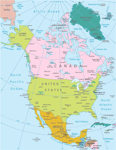
Map of North America
| Pacific Ocean | West |
| Atlantic Ocean | East |
| Arctic Ocean | North |
| South America | South |
Important!
Isthmus of Panama joins North America with South America.
The Bering Strait separates North America from Asia.
Difference between Isthmus and Strait:
Isthmus | Strait |
| It is a narrow land. | It is a narrow water body. |
| It connects two large landmasses. | It connects two large water bodies. |
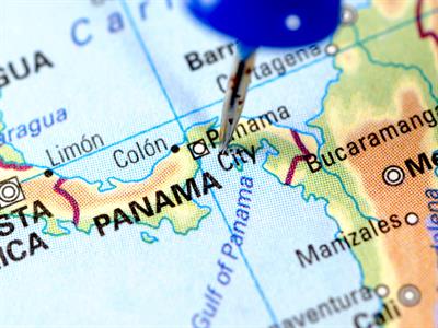
Isthmus of panama
Political Divisions
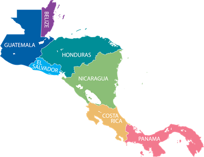
Map of Central America
 Register for free to see more content