PUMPA - SMART LEARNING
எங்கள் ஆசிரியர்களுடன் 1-ஆன்-1 ஆலோசனை நேரத்தைப் பெறுங்கள். டாப்பர் ஆவதற்கு நாங்கள் பயிற்சி அளிப்போம்
Book Free DemoThe Rockies extends for about 4800\ km. Its width varies from 110\ to 480\ km. They are known as the Rockies in the east and the Coast Range Mountains in the west.
The Rockies are a part of a long series of parallel mountain ranges known as the Cordilleras. Sierra Nevada mountain range is in the Western United States between the Central Valley of California and the Great Basin.
In Mexico, they are known as the Sierra Madre. Sierra Nevada or Sierra Madre is a part of Cordilleras. Together with the Coast Range, Rockies are called the “Western Cordilleras.“

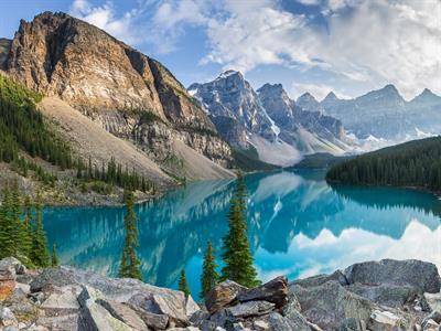
The Rocky Mountain
Some of the high intermontane plateaus found in these ranges are the Mexican plateau, the Colorado Plateau and the Columbian plateau.
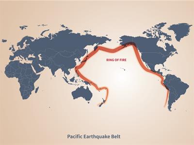
The Cordilleras are a part of the "Pacific ring of fire" because several active volcanoes are present here, and this region is also prone to frequent earthquakes.

The Ring of fire
| Arctic Ocean | North |
| Gulf of Mexico | South |
| Appalachian Highlands | East |
| Rockies | West |
The western portion of the plain is called the High Plains spreading roughly over the foothills of the Rockies. Western Highlands is the source for most rivers in this region, and the plains generally slope eastwards and southwards. They are drained by rivers like the Mississippi and the Missouri.