PDF chapter test TRY NOW
In the previous grade, i.e. grade 6, we have learnt that the earth's surface is highly uneven, ranging from mountain and highlands to valley, plains and trenches. In the same chapter, we also studied about various orders of landforms and how landforms are classified, formation of continents, oceans and continents. In this chapter, let's see landforms of rivers, glaciers etc.
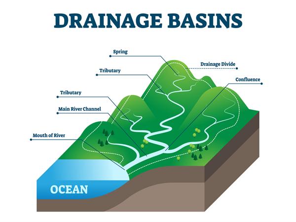
River: A river is a stream of water flowing from an elevated surface towards its drainage with defined banks. Mostly rivers originate from mountains or hills.
River Terminologies
Source: where the stream begins or the place of origin of river.
Mouth: The end of the river where the river joins a lake, sea, ocean or a large waterbody.
‘V’ shaped valley: This is a long trough in the landscape that has been formed due to erosion of the river. V-shaped valleys are usually found in the mountains and hills.
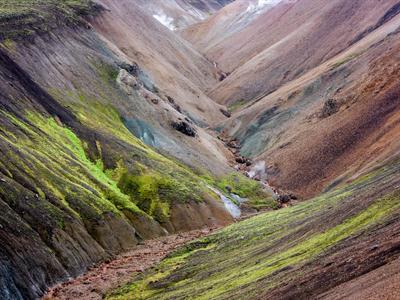
V-Shaped Valley
Tributary: A stream or river that flows into a larger watercourse or main river.
Waterfall: Falling of river water in the steep vertical step in the course of the river. It is formed when the soft rocks are removed by erosion. E.g. Coutrallam falls, and Thirparappu falls in Tamilnadu.
World's highest waterfalls:Angel Falls, Venezuela (South America)
Horseshoe-shaped Niagara falls located on the borders of Canada and the USA. It has one of the highest flow rates.
Victoria Falls is situated on the borders of Zambia and Zimbabwe in Africa. It is located on the Zambezi river.
Horseshoe-shaped Niagara falls located on the borders of Canada and the USA. It has one of the highest flow rates.
Victoria Falls is situated on the borders of Zambia and Zimbabwe in Africa. It is located on the Zambezi river.
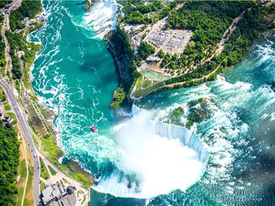
Niagara
Plunge pool: Hollow feature at the foot of a small waterfall in a river. The pool is formed because the water plunging into it has eroded the river bed.
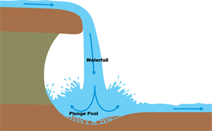
Plunge pool
Alluvial fan: A triangle-shaped deposit of gravel, sand, and even smaller pieces of sediment, such as silt. It occurs when the river enters a plain or the foot-hills.
Meanders: Meander is a bend in the course of a river, formed when the river enters the plain. Here both erosion and deposition take place simultaneously, i.e. an outer stream of the river erodes the outer banks and widens its valley, whereas the inner part of the river has less energy and deposits silt. E.g. Meanders along the River Vellar near Sethiyathope in Cuddalore District, Tamil Nadu.
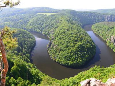
Meander
Oxbow lake: When a meander is sealed off as a result of continuous erosion and deposition, a small arc-shaped lake forms called an oxbow lake.
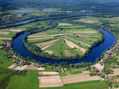
Oxbow lake
Sediment: When river floods, material that has been carried by rivers and then deposited on its banks is called sediment. Sediment may be called alluvium if it deposited on the bed of a river.
Flood plain: It is a flat land of the river valley close to the river banks and is usually found in the lower course of a river. It is a fertile area of land used for agriculture and growing crops.
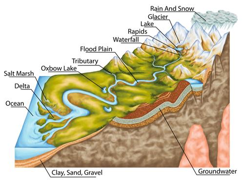
River profile
Levee: Levee is a natural or artificially raised banks that block water from going where it is not intended to.
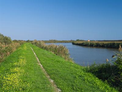
Levee
Distributary: A distributary is a river that branches off from the main river to merge into the sea. A distributary is the opposite of a tributary. Distributaries are a common feature at the deltas, i.e. when the river approaches the sea.
Delta: When a river approaches the sea, the velocity of the river becomes remarkably slow that it begins to deposit its load. Each distributary forms its own mouth. This results in the formation of a fan-shaped area of sediment built up at the mouth of a river with the collection of sediments from all the mouths to form the Delta. Deltas are highly productive and populated lands. With its abundant minerals, it favours cultivation.
Example:
Cauvery delta, Ganges delta, Mississippi delta, Godavari Delta, Mahnadi Delta,Krishna River Delta
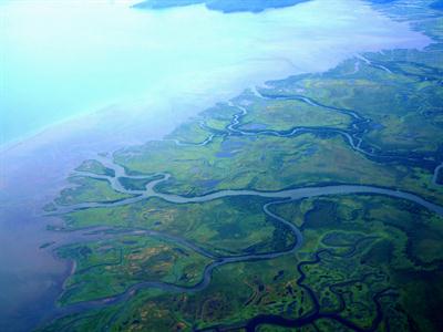
River delta
