
PUMPA - SMART LEARNING
எங்கள் ஆசிரியர்களுடன் 1-ஆன்-1 ஆலோசனை நேரத்தைப் பெறுங்கள். டாப்பர் ஆவதற்கு நாங்கள் பயிற்சி அளிப்போம்
Book Free DemoLarge-scale maps:
Large-scale maps include Cadastral maps and Topography maps made at scales of 1: 250,000 or 1: 25,000, as well as village maps, city zonal plans, and house plans drawn at scales of 1: 4,000 and 1: 500.
1. Cadastral maps:
The word cadastral comes from the French word cadastre, which means "registry of territorial property". These maps are used to illustrate who owns a piece of land by defining agricultural boundaries and the layout of individual houses in urban areas.
Government entities create cadastral maps in order to collect taxes and revenues as well as keep track of who owns what.
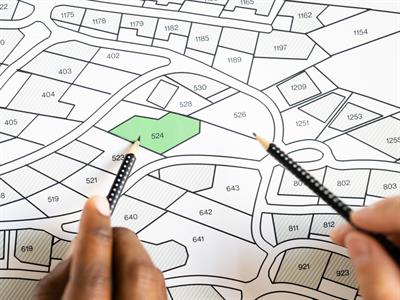
Cadastral maps
2. Topographical Maps:
These maps are made on a quite large size as well. Topographical maps are based on detailed surveys and are produced in the form of a series of maps by national mapping agencies in practically every country.
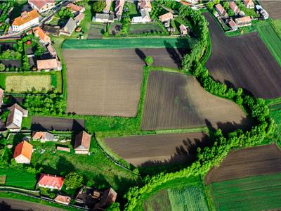
Topographical Maps
Relief, drainage, agricultural land, woodland, towns, means of communication, location of schools, post offices, and other services and amenities are all depicted on these maps using unique colours and symbols.
Small-scale maps:
1. Wall Maps:
For usage in classrooms or lecture halls, wall maps are usually drawn on huge sheets of paper or a plastic foundation. Wall maps have a lesser scale than topographical maps but a larger scale than atlas maps.
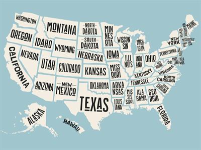
Hand drawn illustration with USA state names
2. Atlas Maps:
Atlas maps are maps with a very small scale. These maps cover a broad area and provide a highly generalized representation of the physical or cultural landscape.
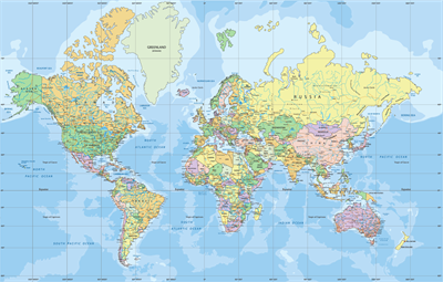
Political World map in Mercator projection
 Register for free to see more content